But First… Science! And Some History.
Swamps, marshes, fens, and bogs. All wetlands, but each name indicates a unique combination of water chemistry, hydrology, and the bacteria and plants that can grow in them. It’s important to have a diversity of wetlands in order to support the unique organisms that have adapted to live in these particular conditions. This is what creates biodiversity – a variety of organisms in varying degrees of abundance (high or low counts of a single species in one location) and richness (a relatively even mixture of multiple species in one location). Without biodiversity, ecosystems collapse and can no longer provide the ecosystem services (naturally occurring processes that have direct or indirect benefits to people) that makes life possible. Wetland ecosystem diversity in particular leads to countless ecosystem services.
In addition to recreation and food supply, humans need wetlands for erosion control, nutrient and toxicant filtration, and water storage to name a few. No matter where you live, clean water supply is in one way or another connected to wetlands. Of all the ecosystem services wetlands provide, however, carbon sequestration may be by far the most important as we approach a global average temperature unsuitable for most life on Earth. Unfortunately, our resilience to climate change has been diminished as a result of the industrial and agricultural revolutions. More on that shortly…
When it comes to climate, wetlands are often discussed in terms of being a source or a sink. Two gasses responsible for much of the exponential increase in temperature over the last two centuries is methane (CH4) and carbon dioxide (CO2). Wetlands can be a reservoir in which either gas is released into the atmosphere (source), or they can be a sink that sequesters and stores gasses in their soil. Many factors influence whether a wetland is a source or a sink and determining this for any particular wetland is a popular subject of recent wetland science research.
One of the hallmark features of wetlands is obviously their wetness, or hydrology. Soils that are consistently wet change color and texture which is an indicator used to determine if land that is wet can scientifically be deemed a wetland. This is a chemical change attributed to a prolonged lack of oxygen due to water saturation. Consequently, saturated soils create an optimum environment to sequester and store carbon from the atmosphere (Mitsch et al., 2012). However, if wetland soils are disturbed and exposed to oxygen, they can become massive CH4 and CO2 sources.
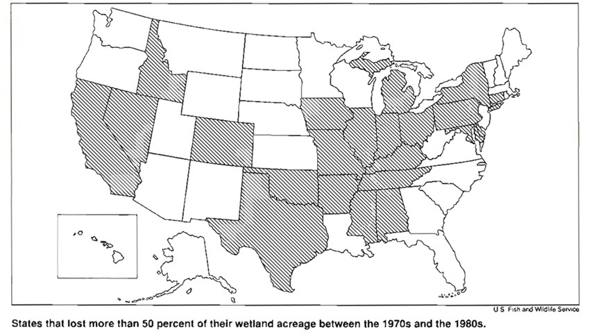
This brings us back to the American industrial and agricultural revolutions. By the 1980’s it is estimated that 104 million acres of the original 221 million have been lost to agriculture and urbanization since the 1780’s, nearly 50% of the original total wetland acreage in the contiguous US. After 200 years of nation-wide wetland drainage, Congress passed the Clean Water Act in 1970, signaling a recognition of the importance of wetland conservation – not only for clean water and wildlife habitat, but for the atmosphere too.
Although federal, local, and state governments tightly regulate wetlands and waterbodies in the United States today, much work still needs to be done to compensate for not only the massive loss of land, but also for the release of untold amounts of greenhouse gasses in the process of progress. Fortunately, Maine has been spared from most of the nationwide wetland drainage between the 1780’s and 1980’s and still retains more than 3 million acres of wetlands (Dahl, 1990). Early in Maine’s history of statehood, expansion of fishing and farming communities along the coast resulted in filling many coastal wetlands, while recent losses are due to urbanization and other development. Even still, wetlands cover approximately 25% of the state, most of which are owned by individuals, timber companies, or private landowners (USGS).
A Maine Treasure
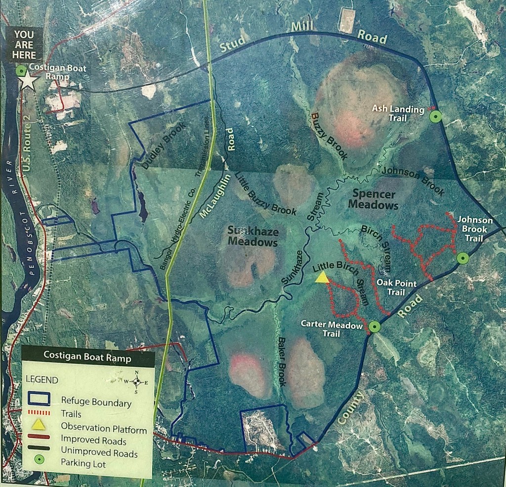
Sunkhaze National Wildlife Refuge is a vast wet meadow/ bog complex that most notably features 5 raised bogs, an unpatterned fen, and a northern white cedar fen (Beginning with Habitat). Together these unique ecosystems make up approximately 8,400 acres of the Refuge. Only 30 minutes north of Bangor, Maine, this extensive wetland connects Sunkhaze Stream to the Penobscot River and includes rare plants like showy lady’s slipper and bog bedstraw. Migratory black terns, least bitterns, sedge wrens and yellow rails can be found here during the breeding season while bald eagles can be seen year round.
The origin of the name Sunkhaze is unclear. In the 1888 publication of the Granite Monthly, a columnist suggests that Sunkhaze may mean dead water, or that the word could be used to describe a stream emptying into another. I couldn’t find any sources that define Sunkhaze, but I presume the origin is of one of the Wabanaki languages spoken in Maine.
Before federal protection and designation as a National Wildlife Refuge in 1988, Sunkhaze was at risk of being mined for peat to be used as heating fuel earlier that decade (USFWS). Instead of acting as a massive sink as it is today, through the excavation process and burning of peat, Sunkhaze would have become major a source of greenhouse gas emissions. Because of increased public environmental awareness, the land is now managed and protected indefinitely by the U.S. Fish and Wildlife Service. The Refuge features walking trails and interpretive signs along the perimeter while the interior can only be accessed by kayak or canoe.
Journey To The Center
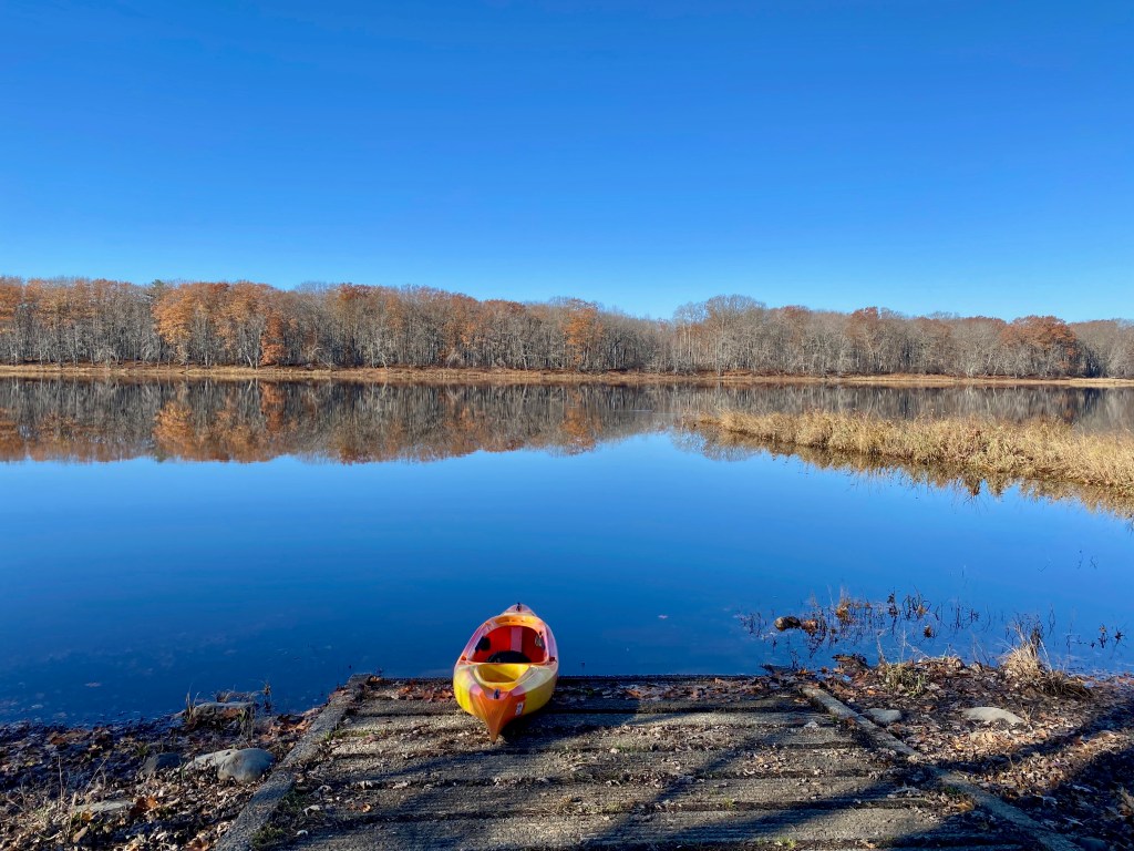
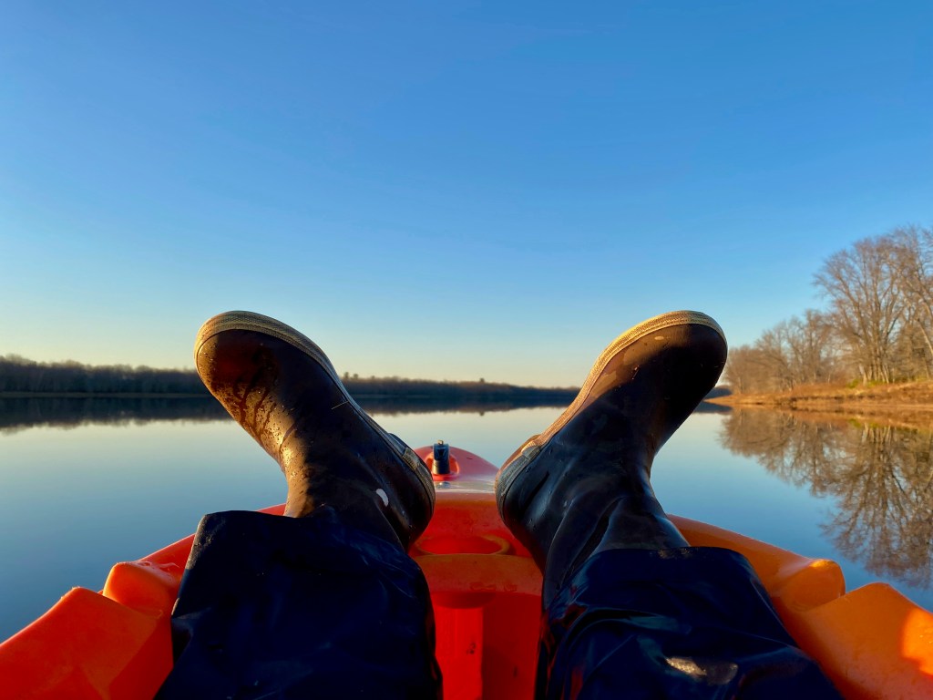
My goal was to reach one of the raised bogs by paddling Sunkhaze Stream. I started my day around 9 am at the Costigan Boat Launch off Route 2 in Milford. It was a brisk, early November morning without a cloud in the sky and nearly no wind. Perfect conditions for paddling the slow, yet powerful current of the Penobscot River that would lead me to my destination.
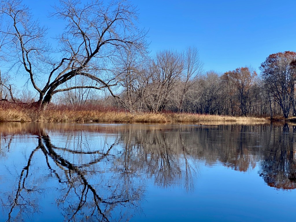
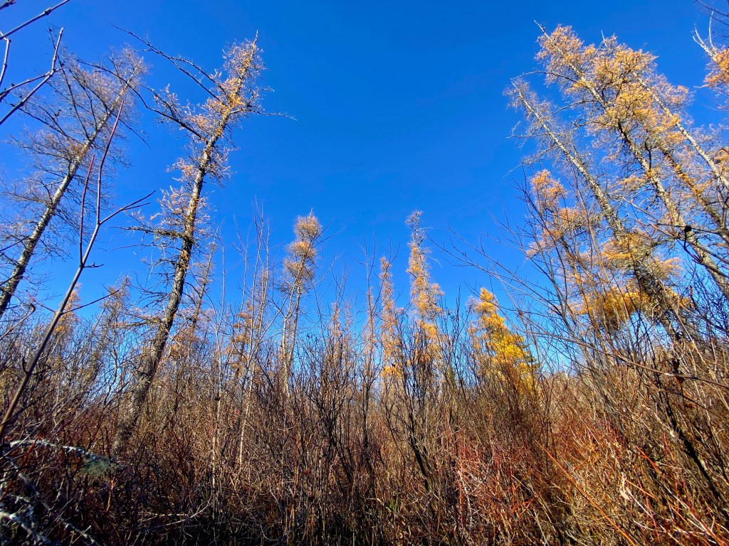
In domed or raised bogs, peat accumulates at the center and maintains a perched (or raised) water table. Elevation is highest at the center and gradually slopes downward toward the area surrounding the bog. Peat depth decreases as distance from the center increases, creating distinct plant communities at each transitional zone known as the plateau (center), rand (sloping margin), and lagg (outer transition zone).

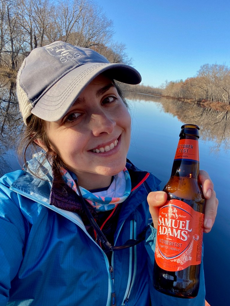
I paddled off the main channel and into the lagg as far as I could, navigating through narrow openings in the leatherleaf. When the water became too shallow to paddle any further, I got out and found a game trail (deer or bear?) toward the center of the bog. The ground was surprisingly solid, but getting much further past the rand was nearly impossible. The rhodora, black huckleberry, and tamarack were too dense, and venturing much further into the bog on my own began to feel unsafe. Considering the amount of daylight left at 1:30 pm, I only had about 2.5 hours to make it back before dark. So after this short exploration, I got back in the boat, opened an Octoberfest because #fall, and paddled back toward the Penobscot.
In total my trip was about 7 hours, time mostly spent in the kayak, and covered 13 miles round trip. It was a nearly silent, mirror image calm day on the water, but when I finally loaded the car right as the sun was setting, I felt a level of pain in my arms that I had never before experienced. FYI: holding your arms in the same repetitive posture for an entire day makes lowering your arms into a comfortable position on your 2.5 hour drive home almost agonizing… Especially if you only ever kayaked for 2-3 hours at a time.

This was my last paddling trip of 2021. As warmer weather approaches, now March 2022, I’m looking forward to being on the water again. Getting back out to Sunkhaze to see the life return to the meadows will definitely be on my list this summer… but maybe after getting a few more trips in elsewhere before tackling this one again.

I have to read and re-read this. Eloquent and educated. I admire you
LikeLike
Great read about an interesting NWR with lots of diversity. Nice to see you are keeping hydrated on your paddle adventures. Keep on Blogging!
LikeLike
Beautiful! I’d love to go there.
LikeLike
Beautiful! I’d love to go there sometime.
LikeLike
Sunkaze Stream is a true marvel. I’ve paddled and fished on the stream for over 25 years. I’d suggest going above the bridge off the County Road in Milford for a true experience! Albeit, there’s a few beaver dams you will have to surpass; it’s truly beautiful up there.
LikeLiked by 1 person
Thanks for the suggestion! I would love to try that approach next time!
LikeLike