Pre-bogventures and local intrigue of Sandwich, Massachusetts
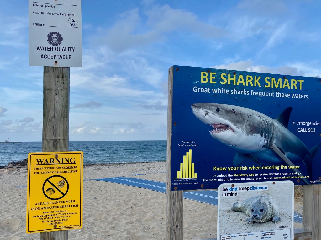
On a Saturday afternoon in mid-October, I got in my car and headed south for Sandwich, MA. The three-hour drive from Portland put me on the Cape at 4:30 pm, leaving me about two hours of daylight when I arrived at the Treehouse Brewing Company parking lot abutting the beach. A large sign, warning of great white sharks in the area, stood between me and the sand. Wanting to make the most of the remaining daylight, I turned to unload my bike, and took the short ride down the street to the Sandwich Boardwalk. I hopped off, strolled over to the beach and took in the choppy Atlantic. Tall dunes curved around the shoreline creating a gray and tan landscape of ocean, saltbox houses, and endless sand.
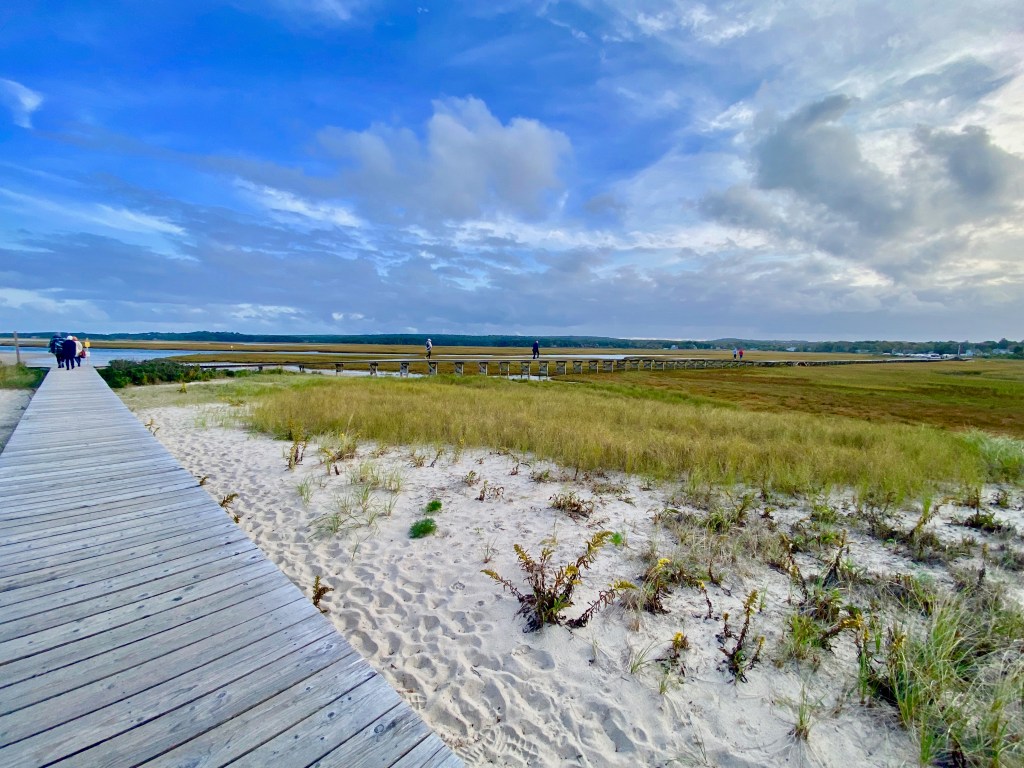
Without the protection of the dunes on the seaward side, the wind whipped through my hair as much as it did the ocean surface. Walking back up the steps that led down to the sand, I set my sights west and crossed the narrow, 1,000-foot long boardwalk that straddles tidal creeks running through the salt marsh, connecting a parking lot to the dunes.
Next, I made my way to Main Street in historic Sandwich, where I rode a 3.5-mile loop that took me past the 367 year old and still operational Dexter’s Grist Mill on Shawme Pond, the Hoxie House built in 1675, and the Heritage Museum and Gardens. Maybe it’s because October is a slower time of year on Cape Cod, but traffic was slow and felt very road bike friendly. The route had a few gentle ups and downs and, on my way back toward the Grist Mill, I caught the strong, distinctively rich scent of the native and edible river grape (Vitus riparia). This deep purple grape is endemic to New England and smells like you would expect “grape flavor” to taste: sweet, yet tart concord jelly.

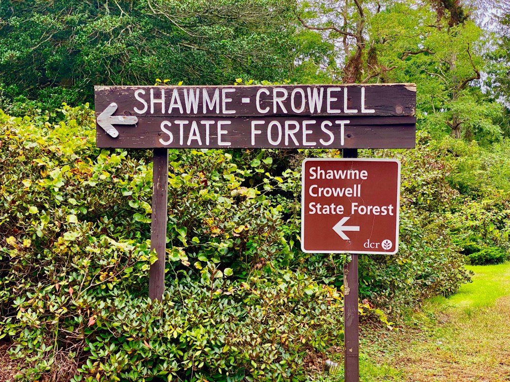
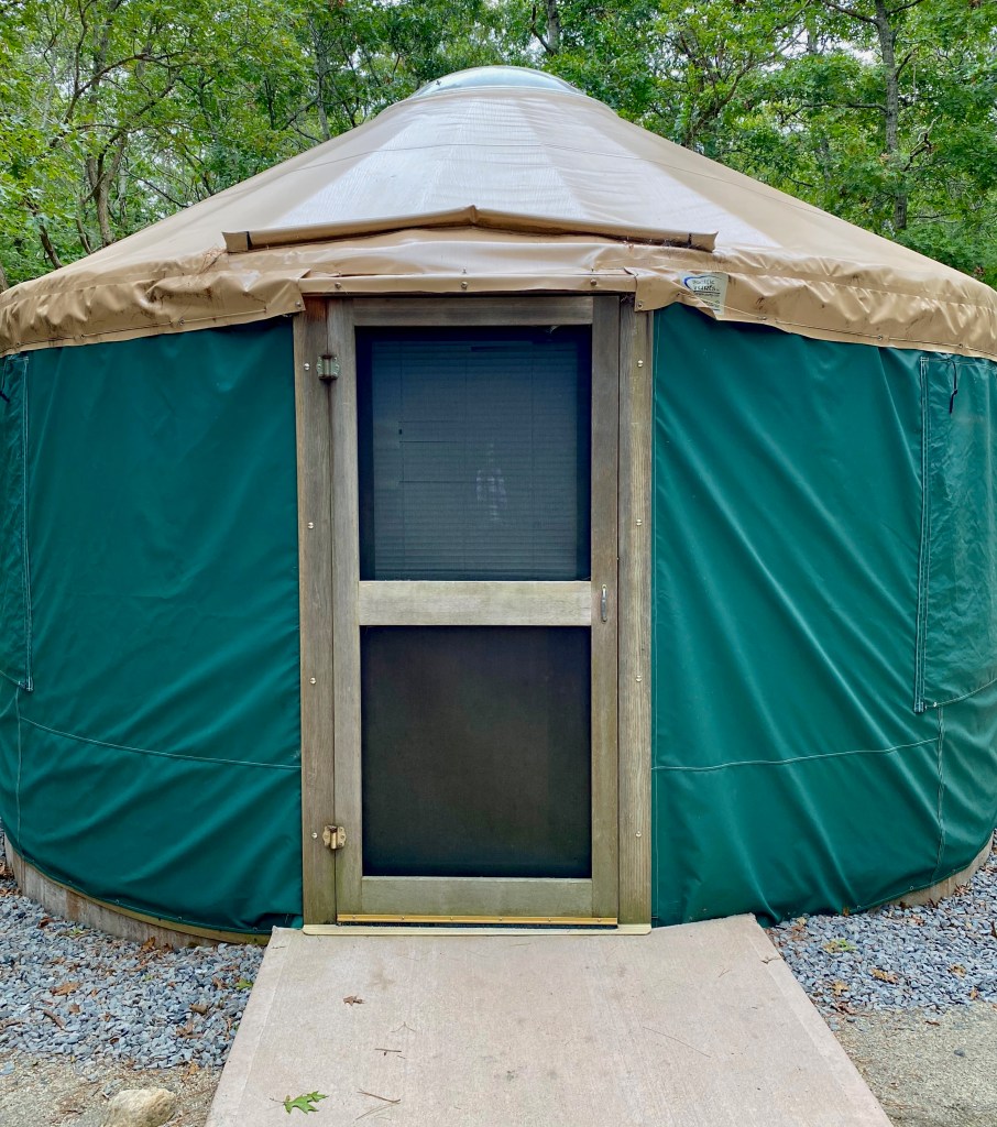
I returned to Treehouse to finish the evening with a beer while watching the sun set on the back deck. Once it got dark, I was ready to call it an early night- it was time to check in to my yurt at the Shawme-Crowell State Forest. It was a mild October evening and the accommodations had a rustic, cozy charm. I lit some candles, made up my bed on the bottom bunk, and nestled in to read a book before falling asleep.
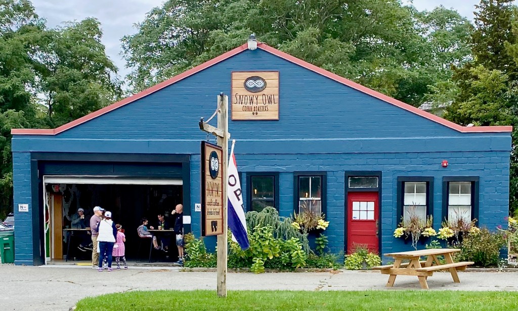
The next morning, I promptly packed up with the first goal of the day to find a charging station for my car and a good cup of coffee at a local café. I parked at a bed and breakfast on Main Street a few miles down the road from the campground to charge the car while I fueled up for a Cape Cod bogventure at Snowy Owl Coffee Roasters. A short stroll led me to the three-in-one roastery, cafe, and bakery where I ordered a single-origin espresso latte and a freshly baked breakfast empanada.
What You Came Here For
The second stop of the day was The Bogs Mattapoisett River Reserve, cared for and owned by the Buzzards Bay Coalition of Mattapoisett, MA. Buzzard’s Bay is named for the abundance of ospreys, formally referred to as buzzards by European colonists. Buzzard’s Bay is home to approximately 8,000 acres of working cranberry bogs, most of them partnered with Ocean Spray.
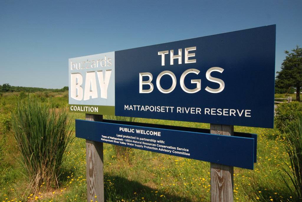
I met up with my local guide, Tom Richardson, host of the television show and YouTube channel Explore New England to learn about the property and walk some of the 5 miles of trails through the preserve. The Bogs is a network of decommissioned cranberry bogs that ceased production in the mid-2000’s. In addition to cranberry production, I learned that bogs in this region also played a significant roll in the iron industry.
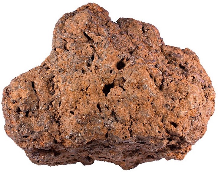
So called bog iron (composed primarily of geothite or limonite) is formed when acidic, oxygen deprived, iron-bearing groundwater comes in contact with the air. Iron particles in the water then become oxidized by dissolved oxygen in the surface water or by iron-metabolizing bacteria. The chemical change causes the precipitation of fine-grained iron solids. The solids accumulate over hundreds of years to create a mineable ore. Bog iron was first smelted by the Vikings and was easy to process because it did not have to be molten to remove impurities. Bog iron was mined in Virginia, Massachusetts, New Jersey, Maryland, and Maine as early as 1608 and as late as 1854. This source of iron in the United States was quickly depleted and was found to be less profitable compared to the plentiful iron deposits in rock found in Minnesota, Michigan, and Utah.
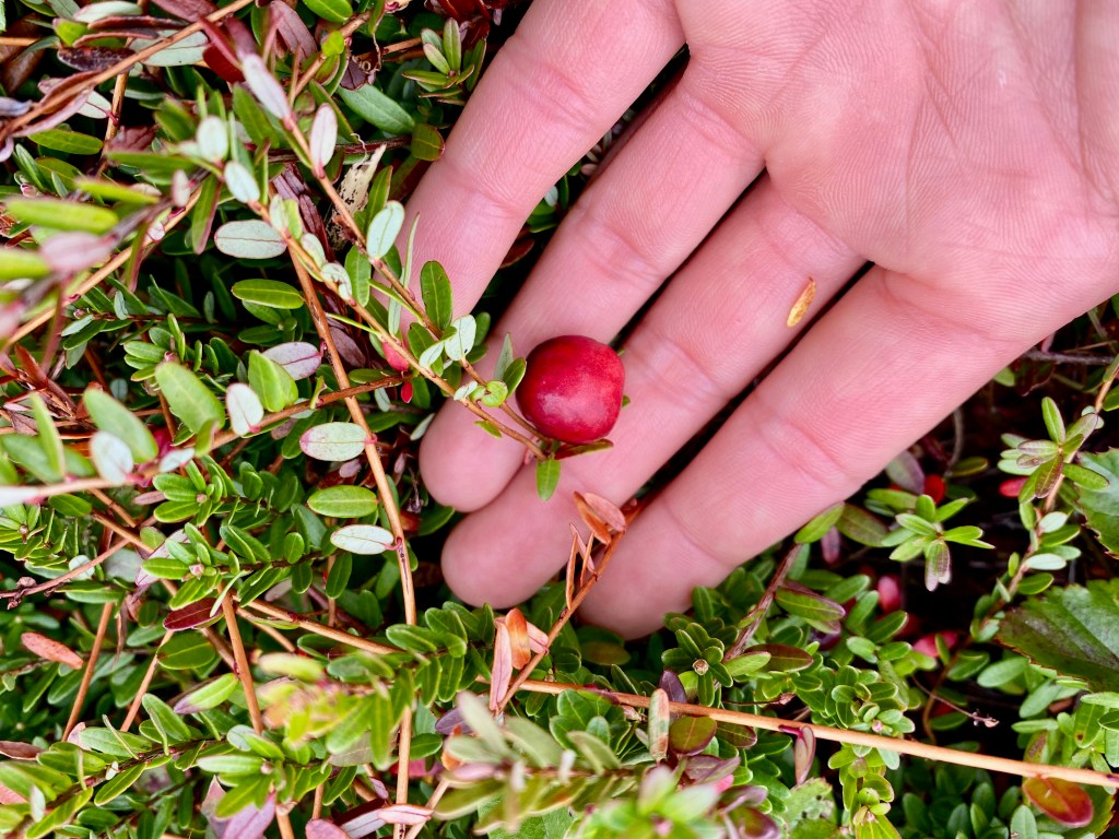
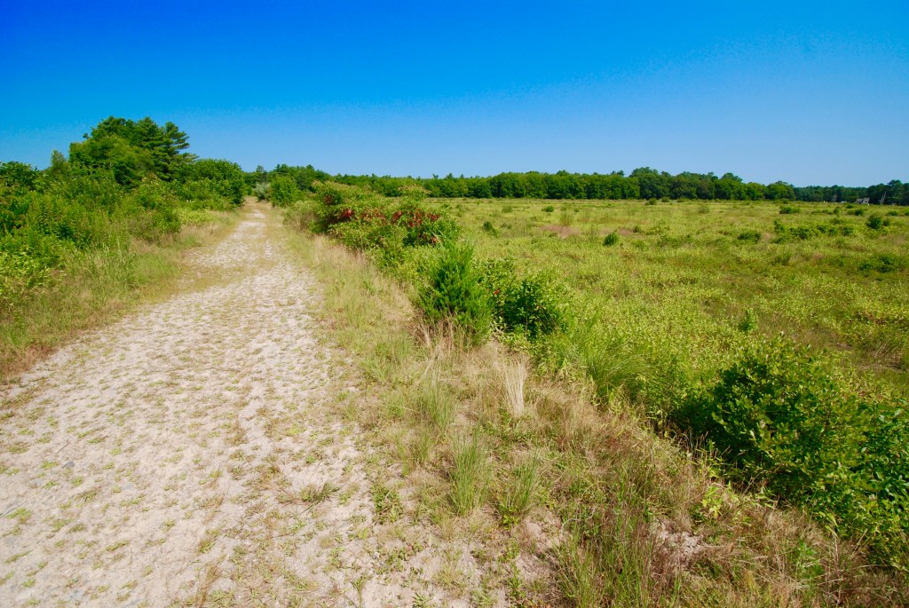
We walked along the berms that separates each plot, peering down at the wetland where strands of cranberries still linger which visitors are encouraged to pick. Now dominated by scrubby vegetation such as alder, buttonbush, white pine saplings, and meadowsweet, the native vegetation is slowly taking over now that the Coalition is allowing nature to take its course. The trails meander into the woods and crisscross over forested wetlands, streams, and ponds. Last winter, The Bogs was designated as a priority project by the Massachusetts Division of Ecological Restoration. This designation will help fund the engineering needed to find the best solution to restore the property’s streams and wetlands from its centuries-long history of natural resource extraction.
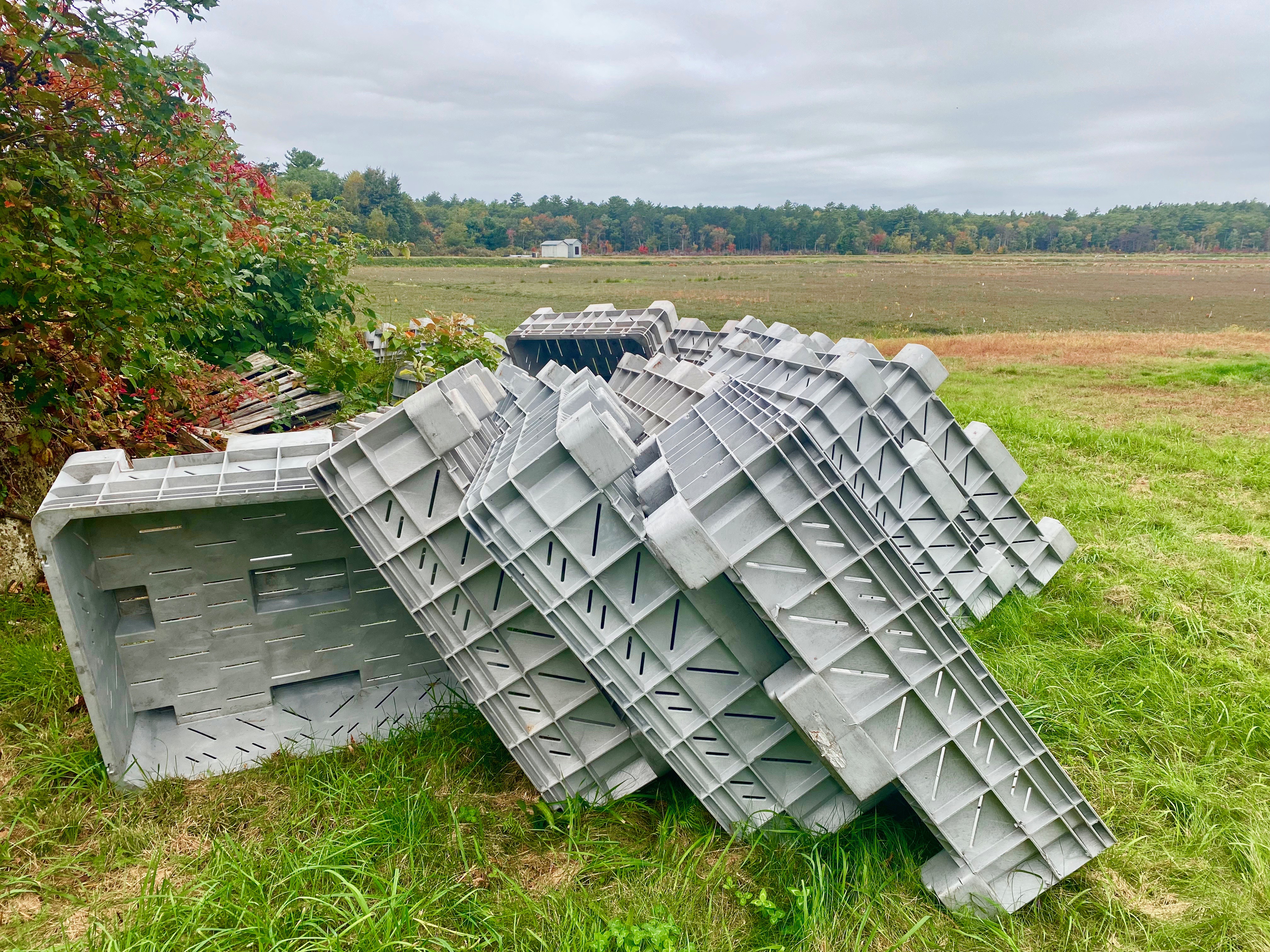
Tom and I made a second stop at the at the Goldovitz Bog Conservation Area in Marion, MA to see one of the region’s working bogs in action. With crates stacked and ready to be filled with plump red berries along the berms, it was clear upon our arrival the harvest was just days away. Cranberries are grown in moist soil, but most bogs have a pond, either man-made or natural, adjacent to the plots. Water is then pumped into the depressions so that the fruit are submerged deep enough for tractors to shake them loose from their stems and corral them into a portion of the bog so they can be easily gathered.

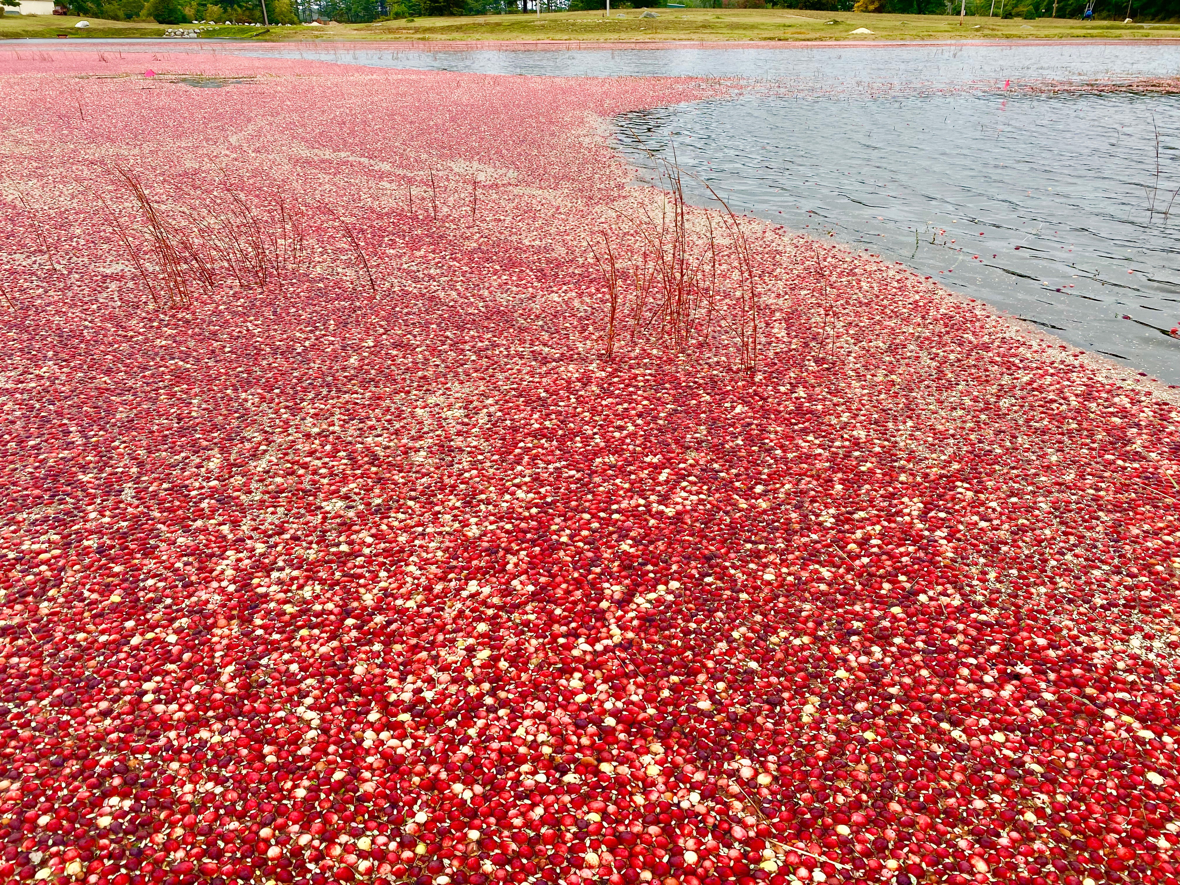
Harvest sequence: The bog is flooded and cranberries are shaken loose from their stems. Crates are used to gather berries for sale at local markets. Larger cranberry operations fill semi-truck beds headed for the Ocean Spray processing facility in South Carver, MA.
Cranberries are adapted to grow in low-nutrient conditions which means less fertilizer is needed to replenish the soil following each growing season compared to other crops such as apples, corn, and, wheat. Cranberry bogs in Massachusetts are composed primarily of sand and mineral soils with a thin layer of decomposed organic matter (peat) on top. Over many years of plants growing and dying, older bogs develop a thicker layer of peat which enables the bog to retain higher concentrations of the nutrients essential to plant growth: nitrogen, phosphorus, and potassium. In this case, some cranberry farmers don’t need to fertilize there bogs at all because the soil is already so nutrient dense. Conversely, younger bogs need a little boost to replenish what was taken up for the cranberry plant to photosynthesize and produce fruit (Cranberry Production: A Guide for Massachusetts).

While fertilizers are used in bogs for large-scale production, their contribution to the excess nutrient problem in Buzzards Bay is minimal. Stormwater runoff in developed areas, local septic systems, and lawn fertilizer are the primary culprits of excess nitrogen into the Buzzards Bay watershed. This is a problem for the bay because it provides food for algae to grown which eventually decomposes, taking up dissolved oxygen in the process, and choking the water, and making it uninhabitable for fish and shellfish. Excess pollution is also killing eelgrass, a plant that small fish, crustaceans, and gastropods depend on to hide from predators. When algae becomes too abundant, the water gets so murky that sunlight is unable penetrate far enough into the water column for the eelgrass to photosynthesize. Luckily, the Coalition is fighting to reverse the negative effects of nitrogen pollution by pushing for state and federal cleanup plans for all of Buzzards Bay’s rivers, coves and harbors, conserving wetlands and forests that remove excess nutrients in the water before it enters the bay, and demanding that septic systems near water reduce nitrogen. Much work still needs to be done, but with the Collation’s activism, Buzzards Bay stands a chance at being a healthy and clean ecosystem for all to enjoy.

What a great treatise. I loved reading your words and thereby envisioned where you were Curt
LikeLiked by 1 person
Thank you! And I’m honored that you would use the word treatise to describe my writing 🙂
LikeLike
Hi Sarah,
I enjoyed reading your blog! I live on a cranberry bog in Marstons Mills which is slated to be restored to a wetland to help with the nitrogen issue that you spoke about. I recently learned that there is so much nitrogen in the bog (from septic systems and lawn fertilizers) that the bog farmer does not need to use fertilizer! Thank you for everything you do too protect our environment! And, if you ever need another bog to blog about please give me a shout!
Sandy
LikeLiked by 1 person
Wow, that’s fascinating that there are already so many nutrients in the soil! Amazing the impact those two sources have when they accumulate to such great quantities. Will do, thanks Sandy!
LikeLike
Another great read Sarah. It always leaves me wanting to add this place to my list of places to visit. Hopefully the nitrogen issue can be resolved.
Thanks for the the Bog Blog post.
LikeLike
It’s interesting that you bought into the Buzzards Bay Coalition anti agriculture propaganda hook line and sinker and parrot it without any fact checking or doing any independent research.
I realize that a blog is essentially an opinion piece .. but you do a disservice by spreading false and misleading information regarding cranberry farming.
In fact very little nitrogen is used or applied to the cranberry bogs in commercial crop cultivation.
There’s lots of nitrogen available in the soil.. which is generally a decomposed peat base. In commercial growing nitrogen is applied to essentially replace what is removed each year by the crop… keeping the environment on the bog balanced.
The degradation of the water quality in Buzzards Bay is actually largely due to phosphorus.. which comes from a variety of sources.. mainly unregulated home owner and lawn companies applications of excess fertilizer to the ever growing suburban mono culture lawn landscape.
Wrongly blaming commercial agriculture.. which is highly regulated and is in actuality keeping large tracts of land in SE Mass from being developed into suburban housing developments (with it’s over fertilized lawns and nitrogen and phosphorous leaching septic systems)does everyone a disservice.
LikeLike
Dear Cran Farmer,
Thank you so much for taking the time to explain your position to me. You’re correct, I did rely heavily on the information and resources the Buzzards Bay Coalition has on their website about pollution in the bay. I never meant to point the finger at agriculture as the primary source of nutrient pollution, my intention was to list it as one example, given the theme of my blog. Lumping agriculture into the primary sources of pollution ( e.g. lawn fertilizer and sewage) is misleading and should have been more carefully worded. I would have loved to met with a cranberry farmer while in the area to discuss the process and ecology, but this trip came up last minute and I did not have time to do much planning ahead. I’m happy to continue this conversation with you, but in the mean time, I am going to do some additional research on cranberry farming so I can update my post with more accurate language.
LikeLike
The post has been updated!
LikeLike
You may be too far away to have insider’s knowledge, but do you have any recommendations for bog sites in Virginia?
>
LikeLike
Hmm good question! Bogs in Virginia are more rare due to the warmer climate and local geology. Just doing a quick search on google maps, I found a conservation site recently acquired by the DCR called Cherry Orchard Bog Natural Area. Unfortunately, public access to the bog has not yet been established. The state has a really nice write-up on the site, describing this really unique and super interesting ecosystem:
https://www.dcr.virginia.gov/natural-heritage/natural-area-preserves/cherryorchard
If you’re not on the coastal plain, I imagine the Highlands of Western Virginia are your best bet for finding a bog. Small bog ecosystems tend to form in shallow bowls or pockets higher in altitude (near or above tree line) where rain water or snow melt accumulates on top of impervious surfaces such as exposed bedrock. Look for sphagnum moss, cotton grasses, and sheep laurel. Those plants are give aways of a wet, low pH environment.
LikeLike